

Global Navigation Satellite System, or GNSS, is the general term for satellite-based systems that allow receivers on or near Earth to determine their precise location. GNSS technology is used every day across construction, surveying, mapping, agriculture, transportation and other industries where precise location matters.
GPS, the satellite navigation system operated by the United States, is one part of GNSS. Other global satellite constellations include Europe's Galileo, Russia's GLONASS and China's BeiDou. Modern GNSS receivers can use signals from multiple constellations at the same time, giving users access to more satellites and helping improve positioning availability and performance.

How does GNSS determine your location?
GNSS works by measuring the distance between a receiver on Earth and satellites orbiting the planet. Each satellite continuously broadcasts signals containing information about its position and the precise time the signal was transmitted.
A GNSS receiver picks up those signals and measures how long they took to arrive. Because radio signals travel at the speed of light, the receiver can use that travel time to calculate its distance from each satellite.
Distance to a single satellite isn't enough to fix a position. By measuring distance from multiple satellites with known locations, the receiver can use a process called trilateration to calculate where it is. A GNSS receiver generally needs signals from at least four satellites to calculate its three-dimensional position and account for the difference between the highly accurate clocks aboard the satellites and the less precise clock in the receiver.
The result is a position expressed through coordinates such as latitude, longitude and height.
Is GNSS the same as GPS?
Not exactly, though the terms are often used interchangeably.
GPS, or the Global Positioning System, is the satellite navigation system operated by the U.S. government. GNSS is the broader category that includes GPS along with the other satellite navigation systems operating around the world.
For many years, GPS was the system most people knew and used. Today's professional GNSS receivers can track multiple constellations simultaneously. Having more satellites available can improve satellite geometry and make it easier to maintain a reliable position, particularly when part of the sky is obstructed.
How accurate is GNSS?
GNSS accuracy varies significantly depending on the receiver, surrounding environment, satellite availability and whether correction data is being used.
Positioning without high-precision correction information can be sufficient for everyday navigation, but professional applications often demand much greater precision. A surveyor establishing a property boundary or an excavator working from a digital design, for example, may need centimeter-level positioning.
Professional GNSS systems can achieve this higher level of precision by using correction technologies. Real-time kinematic, or RTK, positioning typically uses correction information from a reference or base station at a precisely known location. Other approaches, including precise point positioning, or PPP, use correction services that model errors associated with satellite orbits, clocks and the atmosphere.
With the appropriate receiver and correction method, GNSS can provide the centimeter-level positioning required for demanding construction, surveying, mapping and other professional applications.
What can affect GNSS accuracy?
Satellite signals travel thousands of miles before reaching a receiver, and several factors can introduce errors along the way.
The atmosphere can delay signals. Buildings and other structures can reflect them, creating what is known as multipath error. The number and position of satellites visible to the receiver also matter, and trees, buildings, terrain and other obstructions can make it more difficult to maintain access to enough high-quality satellite signals.
Professional GNSS performance isn't determined by an accuracy specification alone. Receiver and antenna design, the number of satellite constellations and frequencies a system can track, correction services, signal processing and the ability to perform in challenging environments all influence real-world results.
How is GNSS used in construction and surveying?
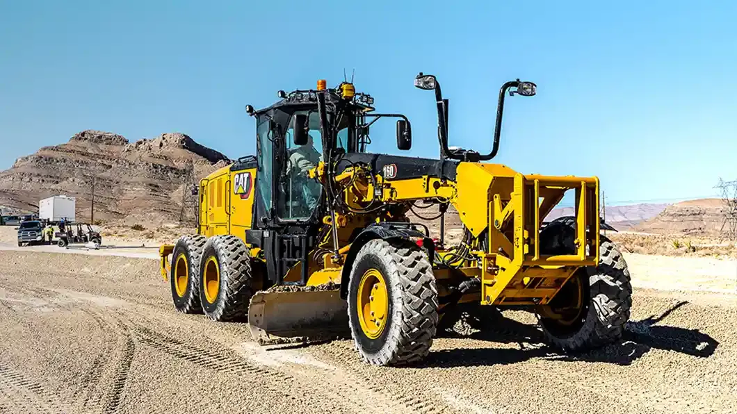
GNSS has become fundamental to many construction and geospatial workflows. Surveyors use GNSS to establish control, collect precise coordinates, locate boundaries, map assets and perform construction layout. On construction sites, GNSS positioning can guide heavy equipment through machine control systems, helping operators work accurately from digital designs. Contractors can also use GNSS to measure progress, verify completed work and tie field locations back to the project information used in the office.
These applications share an important requirement: positioning information has to be dependable enough to support decisions and work happening in the physical world.
As construction and geospatial operations become increasingly digital and connected, GNSS provides much of the location intelligence that ties those digital workflows to real-world places, machines, assets and projects.


