Surveyors using GNSS in South Australia face challenging conditions when working across vast terrain without the investment or population distribution to support a statewide real-time network. As a result, surveyors in outlying areas must rely on static techniques to establish local control.
They can then use single-base real-time kinematics (RTK) for specific project operations, while multiple RTK bases are often needed to produce adequate coverage and accuracy. The static plus RTK method provides good results, but covering large regions adds significant time and cost to any project.
Approach
Trimble CenterPoint® RTX Positioning Services with Trimble R10® GNSS receivers were used for remote surveying of cadastral applications. Surveyors collected more than 90 real-time measurements and found more than 30 percent of the real-time measurements agreed to within two centimeters of the static observations and 73 percent within five centimeters. The typical time to initialize (or converge) the CenterPoint RTX solution was 10 to 15 minutes, which was reduced to less than five minutes with the quick start method.
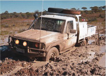
“CenterPoint RTX is a good tool in areas where control is sparse and there are no real-time networks. It produces accuracies that otherwise would be very expensive to achieve.” — Joe D’Aloia, Survey Manager, Fyfe Pty Ltd.
Results
By eliminating the need to establish control and manage RTK base stations, the CenterPoint RTX solution produces significant time and cost savings. The ability to provide real-time positions quickly with accuracy of a few centimeters gives Fyfe an advantage over competitors using conventional RTK surveying.
About Trimble CenterPoint RTX
Built on Trimble’s exclusive RTX technology, Trimble CenterPoint RTX provides high-accuracy GPS positioning services via satellite or cellular delivery worldwide. It’s ideal for jobs requiring high accuracy in remote locations.


