
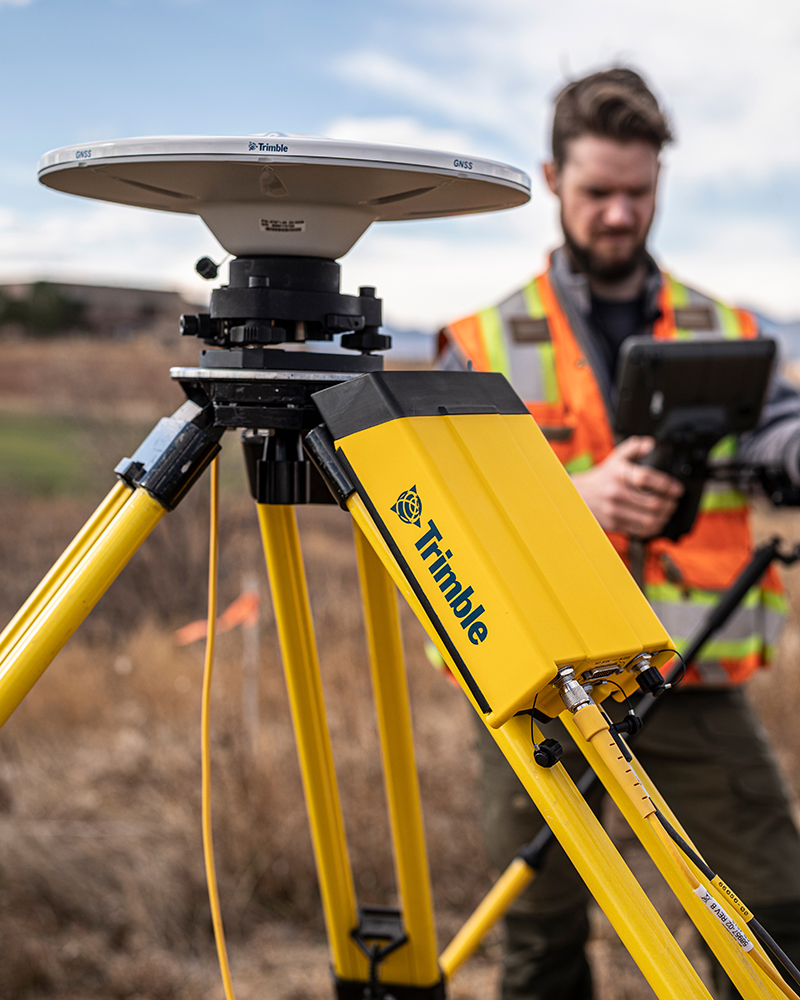
Trimble RTX + Trimble GNSS receivers
Match made for performance
Newly purchased Trimble® R980, R12i, R780/R780-2, R580, R750/R750-2 and MPS566/MPS566-2 GNSS receivers will include an activated and ready-to-use Trimble RTX subscription for the first 12 months. Annual renewal options available for continued access.
Benefits and performance
CenterPoint RTX - a valuable tool in your surveying toolset - expands your options of available GNSS correction methods, enabling you to choose the best solution for the job.
Accelerate your operations
Enables true mobility to boost productivity, simplify your workflow and lower operating costs when used as a primary correction method for precise surveying.


Complement traditional RTK methods
Maintains centimeter-level precision for uninterrupted work when used as positioning insurance — a backup correction in the event of RTK connectivity disruption.
Return on investment calculator
If you utilize Trimble RTX on the next project where it's a great fit, will the cost savings pay for the subscription?

High accuracy
2 cm (H)/3 cm (V) [RMS]
Interoperable with RTK
Works in your local coordinate system
Global service
Via satellite and/or internet
Match made for performance
Trimble R980
The best just got better
The Trimble® R980 GNSS system unlocks peak accuracy and productivity for land surveyors with proven GNSS performance.

Trimble R12i
A new angle of productivity
The Trimble® R12i GNSS system delivers unmatched GNSS performance and accuracy to boost the productivity of land surveyors like never before.

Trimble R780
Freedom to work your way
Ultra-rugged scalable receiver to meet the exact needs of your GNSS-based workflow today, and tomorrow. Powerfully simple positioning.

Trimble R580
Proven, reliable positioning
Powered by the industry-leading Trimble ProPoint® GNSS engine, this everyday integrated receiver delivers greater productivity and reliable accuracy.

Trimble R750
Work with global precision
Get reliable coverage no matter where you are. Work efficiently and accurately, while receiving all the information you need, right at your fingertips.
Configuring Trimble RTX
Trimble Access™ field software
- Open Settings and select Survey Styles
- Create a new GNSS Survey Style named ‘RTX SV’
- Edit the rover options
- Change the Broadcast format to ‘RTX SV’
- Check the constellations you want to track
- Store and escape to the map
- Start a survey using your new ‘RTX SV’ Survey Style
- The connection icon will show a satellite once you receive corrections
- Wait for your precisions to converge to your defined tolerances
Trimble Siteworks positioning systems
- In Receiver Setup, set mode to Rover
- Choose your connection type
- Set the Correction Method to 'CenterPoint RTX' or 'RTX via Internet'
- Input your desired horizontal and vertical precision parameters
- Enable Quick Release
- Enable Tilt Compensation if desired
- Set your Antenna Height
- Click Accept
- Wait for your precisions to converge to your defined tolerances
Trimble TerraFlex® field software
- In your Trimble Connect Map Workspace select the project required
- Tap the Menu (☰) icon and select Positioning
- Set up real-time correction configurations for the project as required, using RTX (Internet) or RTX (Satellite). Note that you can set up multiple configurations
- In TerraFlex make sure that your projects are synced
- Tap on the Menu (☰) icon and choose Settings
- If you are not already connected to your GNSS receiver, connect to the Location Service
- Tap on Real-time Configuration and choose the Trimble RTX correction configuration you created above
Trimble FieldLink layout software
- Open the Device Menu
- Connect to your RTX-enabled GNSS device
- Select ‘RTX’ as your correction method in the Workslate
- Configure your RTX preferences
- Satellite
- Internet (Global / European Union / North America)
- Press the Store button
- Wait for the precision values to converge
- Ready to start
Trimble Mobile Manager software
Version 4 and later:
- Tap Configuration to set GNSS correction source to Auto
- Tap Home
- Connect to your position source if not already connected by tapping Select
- Wait for your precisions to converge to your defined tolerances
Version 3 and before:
- Choose your Position Source
- Tap the Menu (☰) icon and choose GNSS configuration
- Set GNSS correction source to Auto
- Tap the Menu (☰) icon and choose Home
- Move the slider to connect to your position source
- Wait for your precisions to converge to your defined tolerances
Choose the right tool for the job
Learn more about how CenterPoint RTX can boost your productivity.

With a fast convergence of under one minute in select regions, CenterPoint RTX delivers RTK-level performance to which surveyors are accustomed. CenterPoint RTX caters to all surveying fieldwork needs, from stakeouts to as-builts, with reliable centimeter-level accuracy.
CenterPoint RTX is not affected by radio or cellular signal interruptions (radio dead spots, unreliable cell coverage, or cellular connection) or unexpected disturbances (RTK-network outage or compromised base). This means CenterPoint RTX correction acts as your positioning insurance in the event of radio or real-time network disruption so you can maintain your accuracy in your local coordinate system indefinitely (or until your primary correction is restored) using xFillx mode.
As both a satellite and Internet-delivered service, CenterPoint RTX is always available no matter where you are. You are not tied to one location as with terrestrial correction sources, and your rover and CenterPoint RTX move with you. No need to worry about the RTK-network footprint, finding a good location for your base station, or the PPM error component when traveling away from the base and increasing your baseline length.
CenterPoint RTX corrects for all available constellations. If you're using a low-quality local base, or you're on a third-party real-time network without full constellation support, switching to CenterPoint RTX correction will increase satellite availability.
Rover-only setup with CenterPoint RTX correction enables the use of all receivers as rovers, maximizing the efficiency of crews in the field. Read our blog series to help you choose the best GNSS correction tool for the job.
Resources and knowledge

Software workflow compatible
An integral part of Trimble survey software workflows, including built-in time-dependent transformations. Learn how to configure Trimble RTX in Trimble Access™ software.

Real-time certainty
Discover how CenterPoint RTX correction provided confidence and efficiency on land, air, and water and worked the way this crew needed it to work.

Match made for performance
Unlock key insights into the new value proposition for Trimble GNSS users and gain a deeper understanding of this exciting opportunity today.

Wide range of applications
When looking to save time and money, ask yourself: is this a job for CenterPoint RTX correction? A valuable tool every surveyor should have in their toolset.
We value your feedback
Tell us about your experience!
Distributor hub
Unlock exclusive content!
